



By TIM WILCOX
Special to the Alpine Mountaineer
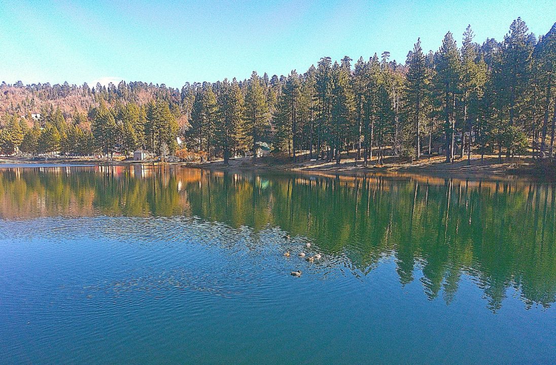
Viewed from the sturdy dam on a crisp and calm December afternoon, Green Valley Lake is a nine-acre mirror. (Photo by T. Wilcox)
Where: East of Running Springs
Length: 2 miles
Elevation gain: none
Challenge: easy
The three most well-known and popular trails in the western San Bernardino Mountains are Heart Rock in Crestline, Sequoia at Heaps Peak Arboretum near Skyforest and Exploration east of Running Springs. Still, for this relaunch of the Alpine Mountaineer’s hiking column, let’s visit one of our area’s much-less-prominent gems. It’s the pathway around Green Valley Lake.
Here’s how to get there. From the main intersection in Running Springs, motor east and downhill through Arrowbear Lake about 2.5 miles. Turn left onto Green Valley Lake Road, where a sign proclaims, “Above the Clouds,” and drive for another four miles. There’s the lake.
Compared to Lake Arrowhead (782 acres) and even Lake Gregory (84 acres), this is a tiny body of water covering only nine acres. That said, it’s definitely a lake and not a pond. This too: It feels like the perfect size for this charming alpine hamlet.
On the trail
Park in the town’s main lot across from the Lake Inn Restaurant, Log Cabin Café and general store. Look for two tall yellow snow poles and walk between them onto the pathway that traces the lake’s shoreline. Turn left there.
You’ll immediately notice how quiet it is here at year’s end, with the beach and playground closed for the season. Apart from occasional passing vehicles, only a few quacking ducks break the stillness. That’s OK. They’re making natural sounds, not noise.
Because the elevation here is 7,200 feet, pines and firs predominate in the company of scattered oaks. For whatever reason, Jeffrey pines appear to outnumber Ponderosas. Also, almost none of the big trees grow close to one another.
In the near distance is a small dam that backs up the lake. Soon you’ll be crossing that structure, which was built about a century ago. In spots the pathway is somewhat indistinct. Still, staying close to the water ensures that you remain on course.
About two-tenths of mile from your starting point, you’ll walk under a large sign that welcomes visitors to the community. A few steps farther, and you’ll be on Canyon Drive. Follow that roadway past the dam for 10 minutes or so simply to extend your hike. Amble downhill through a residential area of mostly well-kept homes until you encounter one on the right that’s painted bright blue with yellow doors. A dozen paces farther, also to your right, is a large beetle-bored log. Pause there to savor a west-facing view of the San Gabriel Mountains.
Now retrace your steps up Canyon Drive to the dam. Enter its concrete walkway, which is safeguarded for pedestrians by chain-link fencing. On one side the structure is about 40 feet above dry ground. On the other it provides some of the best views of the lake. Especially when the winds are calm, the reflected shoreline and trees are quite lovely.
Once you’ve crossed the dam, take another detour away from the lake. A wide dirt roadway covered with pine needles and oak leaves leads to Maple Lane. Here several homes are built around small boulder fields. Walk down to the street’s dead end, then head back to the lake. As you turn toward the water, you’ll notice one of the first structures built in this community. No longer occupied, it’s a tiny cabin with a sharply angled tin roof.
For hundreds of paces now, as you continue your clockwise transit, the pathway is much higher above the water. (Benches here invite a moment’s respite.) Then the semblance of a beach appears along with a small inlet, which during high season and into early fall shelters water bicycles and canoes. Here, too, a prominent sign reads, “DANGER. Stay Off Ice! Up to $500 Fine.” Until winter really sets in, of course, this is a moot warning.
OK, head north briefly away from the water and gravel parking area. When you come to Wild Rose Drive, turn right and walk along the pavement for several tenths of a mile. Traffic here is light and tends to move slowly. Nevertheless, be cautious, keeping to the asphalt’s margins.
On the right is the lake’s principal beach. There’s also a small bridge that leads through a paved playground and picnic area, ending up at the town’s main parking lot. You could conclude your hike here. But why be abrupt? Instead, if you feel inspired, continue along the roadway away from the lake – again, to extend your outdoor adventure. This is a relatively nondescript, but not unpleasant, stretch.
When you come to Lakeside Drive, proceed for another tenth of a mile or so. Then, at the stop sign, turn right again onto Green Valley Lake Road. A few minutes later you’re back where you started, having clocked about an hour on the trail.
NOTES: At an elevation of 7,200 feet, Green Valley Lake is the highest community in the San Bernardino Mountains. During off-season months in particular, it’s a serene setting for a pleasant stroll at water’s edge and elsewhere.





0 Comments