



By TIM WILCOX
Special to the Alpine Mountaineer
Where: Lake Arrowhead
Length: 3.25 miles (round trip or optional route)
Elevation gain: 772 feet (return leg)
Difficulty: easy (descent), moderate to semi-difficult (ascent)
Let’s talk about expectations for a moment – specifically, regarding a hiking destination whose official name is North Shore National Recreation Trail. Presented with such an impressive title, you’d expect it to be one of our mountains’ most-accessible and well-traversed routes. It’s not. Instead, the trailhead is hidden away in the North Shore Campground above Lake Arrowhead, where there’s no “day use” parking. And now, of course, that campground is closed for the season. Compounding the irony, the route’s name is a prime example of “title inflation.” Pardon the obvious, please, but a much more appropriate and less pretentious moniker is North Shore Trail.
If you’re still interested/curious, you’ll need to find your way to MacKay Park, which is above Highway 173 and near Mountains Community Hospital. Find a spot for your vehicle there. Now walk east along Hospital Road past the popular “bark park” (listening and watching for oncoming traffic around the blind curve) until you reach the entryway to the Lake Arrowhead Community Services District’s new corporate yard. Continue for a few more steps, then go left onto Rouse Ranch Road, which soon gives way to its decades-old dirt format.
Walk through an open Forest Service gate, then downhill for 120 paces or so. On the left you’ll see a pathway winding down from the campground above. Here there’s no point in hiking up to the trailhead. Instead, prefer the route’s continuation on the right. At this juncture you’re about half a mile from MacKay Park.
On the trail
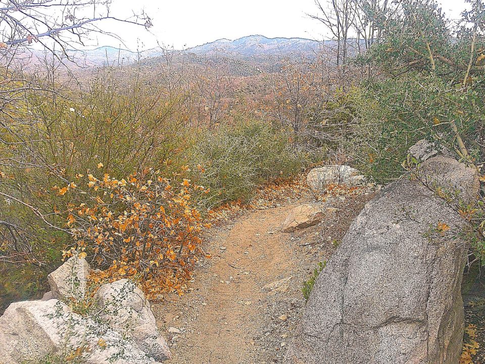
Take the initially wide, descending pathway, which for the next mile follows the convoluted course of Little Bear Creek (dry this time of year). The route soon narrows to between two and three feet, which is typical during most of its length. Because of recent drought years and also a bark-beetle infestation, trees aren’t numerous here. Instead, chaparral is the dominant vegetation. In spots along the trail, these hardy shrubs grow head high and taller on both sides. Tread carefully along the route’s steeper sections, especially those covered with slippery acorns, which might remind you of walking on marbles (if you’ve ever done that).
Thanks to the absence of passing vehicles, you’ll enjoy how quiet it is here. Also, without any thick stands of trees, the trail offers refreshing views in several directions. The vista of mountains above Green Valley Lake to the east is the most striking.
Mind your step again, please, when you come to a steep hairpin curve in the pathway. Winding ever downward, the route becomes more rocky and eventually leads directly across the bed of Little Bear Creek. When the rains come – heavy downpours in particular – this channel will be a roaring torrent. Close your eyes for a moment and imagine that dramatic scene.
Wider and sandier than before, the trail continues. At almost exactly a mile and one-half from your starting point, it bottoms out into a T-intersection with a margin of large downed logs. Turn to the left here and head downhill for a few minutes until you come to a surprise: running water. It’s currently a mere trickle but enough to cover the path ahead, rendering it impassable unless you’re equipped with knee-high rubber boots. As a result, hiking farther down the route to Splinter’s Cabin (near the West Coast’s most famous trail) is ruled out.
OK, return to the T-intersection. Now it’s decision time. You can retrace your steps, winding all the way back up the trail to Rouse Ranch Road, then past the corporate yard and on to MacKay Park. If you choose that option, you’ll end up covering slightly more than 3.2 miles.
There’s another choice, however. You can walk into the forest ahead and follow an off-trail route. Why do that? Simply for the sake of variety and discovery. The relatively level pathway leads past stately Ponderosa pines and across a subsidiary creek bed to a nameless Forest Service road. You’ll amble past scattered, mostly rustic cabins. But one surprisingly large residence to your left is easily the neighborhood’s dominant structure.
Not long after passing this mountain manor house, you’ll be on Big Tree Drive, which is still a dirt thoroughfare. Then, at about the two-mile point of your outing, you’ll come to another intersection – this one marked by a white fence. Turn right here onto Little Bear Creek Road, proceeding on what’s now a slightly ascendant course. Moments after dirt gives way to asphalt, you’ll arrive at Torrey Road.
Ahead is a somewhat challenging uphill trek, extending for about four tenths of a mile. Its most prominent feature is the big rocky dam on the left, which backs up two lakes: Papoose and Arrowhead. When you level out and reach Rouse Ranch Road, take a quick standing break. Then proceed upwards once again, this time for three -tenths of a mile. Soon you’re standing across from the corporate yard again, having mastered the two most difficult sections of your outdoor adventure.
Now retrace your steps along Hospital Road, from which you can see the crests of the San Gabriel Mountains in the western distance. Moments later you’re back where you began. Give yourself a round of applause for completing a 3.25-mile hike. Bravo!
NOTES: This is a mostly narrow, winding trail offering an easy descent through copious stands of chaparral, then an aerobically challenging ascent back to your starting point in MacKay Park. Because of its vegetation and terrain, the North Shore Trail feels more like a hike through high-desert hills than a mountain-trail outing.
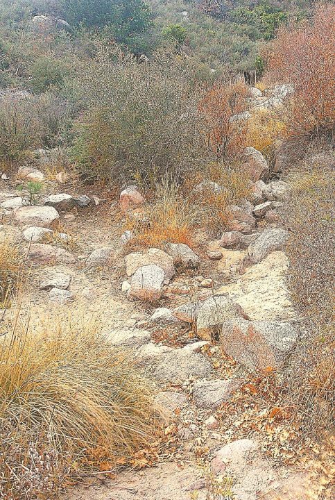
Little Bear Creek is dry much of the year, as evidenced by this view from the middle of its sandy and rocky bed. But heavy rains, mostly during winter, quickly turn it into a rushing torrent.





0 Comments