



By TIM WILCOX
Special to the Alpine Mountaineer
Where: Running Springs
Length: 3.2 miles (round trip)
Elevation gain: 610 feet
Challenge: moderate to semi-difficult
Way back in the 1960s, there was a sixth-grade teacher at what was then Running Springs Elementary School (renamed Charles Hoffman in 1985). Jim Sims was first-rate in the classroom. But he also helped shape the lives of countless students as an enthusiastic and knowledgeable guide on the rough trail rising for hundreds of feet behind the school. His “wonders of nature” hikes there were memorable – in the fullest sense of that word.
Decades later, in 2014, the San Bernardino Mountains Land Trust created an augmented and enhanced trail on its140-acre Coyote Rock Preserve above the school (established to rescue that precious parcel from subdivision development). The nonprofit organization named it the Jim and Kathie Sims Trail, honoring both the teacher and his wife for their exemplary dedication to the school in particular and the community in general.
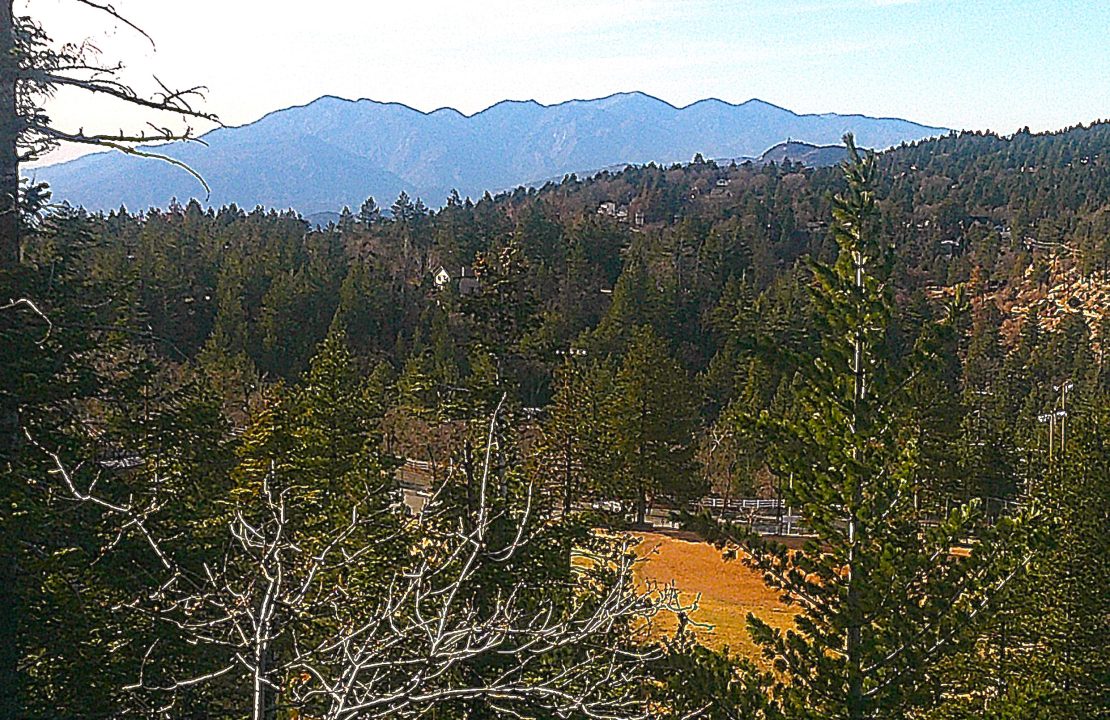
Looking west from a promontory some 300 feet above the trailhead, one can see the elementary school’s athletic field, nearby hills and, silhouetted in the distance, the San Gabriel Mountains.
All right, this is yet another “Let’s Go Hiking” hidden gem. It’s located less than a mile east of the main intersection in Running Springs. Traveling in that direction on Highway 18, drive carefully through the yield sign, then watch for Running Springs School Road. Turn right there and motor just past the elementary school. Finally, make a quick left into the Hootman Community Center’s lot and park as close as possible to the athletic field’s main entrance (to avoid encroaching on community-center spaces).
So, where’s the trailhead, anyway? It’s hidden as well. Walk onto the large baseball and soccer field. Across the expanse of grass, you’ll see two weathered shipping containers. That’s your next, but momentary, destination. Immediately behind the containers is the elusive trailhead. Bear to the left past a chain-link fence. Now you’re finally on the trail itself.
On the trail
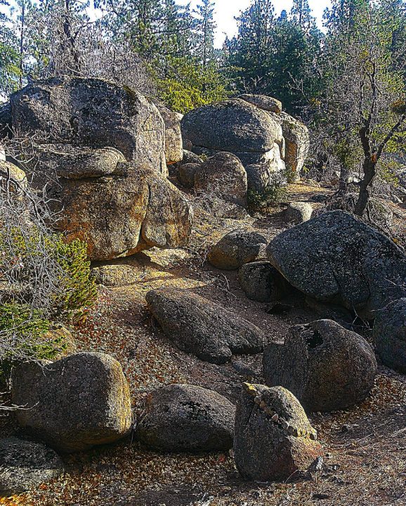
Less than two feet wide at the outset, the path ascends through numerous switchbacks and past looming boulders. This is actually the steepest part of the trail, so you’ll get a bracing aerobic workout at the very start.
At the quarter-mile mark, you’ll see a granite behemoth that’s approximately 40 feet long and 20 feet tall. Immediately after that “Wow!” sight, take the short spur to the right. There, atop another boulder, you can look down on the athletic field and see how far you’ve climbed in just a few minutes. From this vantage, too, the tip of Strawberry Peak appears and, much farther to the west, the San Gabriel Mountains.
Past the spur, the path finally levels out for a stretch before ascending once again. It’s important, of course, to pay attention to the tree population as you proceed. Pines and firs are dominant, while barren deciduous trees are in the distinct minority.
You’ll be impressed by how carefully the trail has been laid out, winding through the boulders. Also, the margins of the trail – along some of the way, at least – are neatly delineated by assiduously placed logs and limbs. The path’s average width now is three feet.
Nearing the 0.6-mile mark, you’ll come to a triangular “construct” that seems more decorative than functional. Maybe it’s meant to be an arrowhead. Whatever the case, you’ve arrived at a major fork in the trail. To the left the pathway remains narrow with many uphill contortions. To the right it widens considerably, heading downhill for an extended stretch. Go that way.
When you come to a dirt road, don’t turn right. Why? Because a quarter mile later you’ll end up on Running Springs School Road.
Instead, bear left up the rocky expanse for half a mile or so. Then, when you encounter another fork, hike uphill to the right on the still-wide pathway. Be aware that it’s easy to meander off course on what looks like the trail but actually leads to a dead end. You may have to retrace your steps and try a different route. There’s no signage here whatsoever.
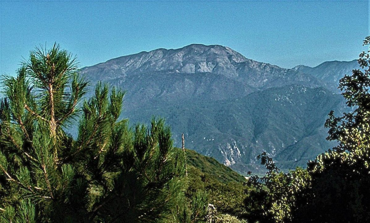
The trail opens up at its highest point, presenting a panorama dominated by San Bernardino Peak, one of Southern California’s tallest mountains. From Highland and Redlands, it has a strikingly different profile, appearing like a stratovolcano.
If you’re successful, you’ll come to the trail’s principal viewpoint – incongruously marked by two wooden lawn chairs. To the east is an absolutely magnificent view of San Bernardino Peak, a massive mountain 10,649 feet high. Looming behind it is San Gorgonio, Southern California’s tallest mountain at 11,503 feet. In the near distance is Keller Peak, just shy of 8,000 feet. This clearing is special not only thanks to the view, but also because it’s so peaceful. Plan to linger there for a while.
Now, refreshed and inspired, you can head down from the trail’s buena vista pinnacle. Retrace your steps until you come to the route’s main intersection marked by the arrowhead construct. From there on it’s a “hiking piece of cake.” Enjoy!
NOTES: “Let’s Go Hiking” contacted relevant authorities to ensure that, in the wake of the Line Fire, the Jim and Kathie Sims Trail is open. It is. The important caveat is that the route’s intersection with the Children’s Forest Exploration Trail is closed. Only the U.S. Forest Service can decide and announce when the “temporary closure” of that much longer and more prominent trail is lifted. Note, too, that three years ago the San Bernardino Mountains Land Trust transferred ownership of the Coyote Rock Preserve, which includes the Sims Trail, to the Forest Service. For more about the nonprofit conservancy, visit www.sbmlt.net.





0 Comments