



By TIM WILCOX
Special to the Alpine Mountaineer
Where: Lake Arrowhead
Length: 2.2 miles (round trip)
Elevation gain: 287 feet
Challenge: easy to moderate
It’s almost more likely that you’ll get lost driving to this destination’s entry point than actually hiking along its ridge-top route. Tunnel II Trail lies immediately west of Lake Arrowhead Country Club, above Brentwood Drive. There are several ways to get here, and driving directions may sound complicated. But with simplicity and efficiency in mind, let’s establish a prominent starting point: the Shell gas station in Agua Fria at the intersection of Grass Valley Road and Highway 189.
Take Grass Valley north about one-half mile to Clubhouse Drive. Turn left and follow Clubhouse for about one-tenth of a mile to Fairway Drive. Turn right on Fairway and proceed for about one-half mile to Brentwood Drive. Follow Brentwood for slightly less than a mile to Sonoma Drive (street sign on your right) and turn left. Approximately one-tenth of a mile on the left is Forest Service Road 2N34 – directly across from Sutter Lane. There’s parking for one or two vehicles by the gate. You also can park off the pavement on Sutter.
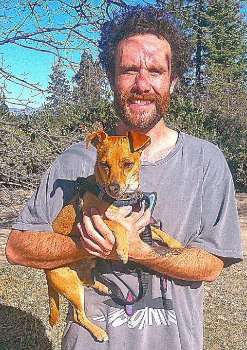
Brandon Campopiano walks and runs along the road adjacent to the trail four or five days a week. Brandon, who moved to Lake Arrowhead from Las Vegas about a year ago, is accompanied by Leo, an amiable mix of Chihuahua and rat terrier.
On the road and trail
Begin your hike on the Forest Service road, which ascends quite steeply toward the actual trailhead. There’s nothing especially noteworthy along this initial stretch, except for the main drainage channel. In spots the runoff from rain has eroded it to more than two feet below the road’s surface.
Two-tenths of a mile from your starting point, you’ll come to a fork in the road. Go right there. Soon you’ll come to a segment that’s even steeper than before. Extending for another two-tenths of a mile, it levels off by an oak that forms a Y. Bear right again and look for two wooden posts on the left. This is the lower trailhead, which is marked by an official sign.
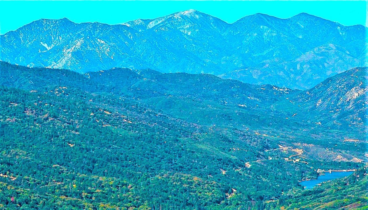
Walk onto the narrow pathway there. Passing through stands of chaparral, it soon leads to a wonderful westward vantage point. A portion of Silverwood Lake shimmers more than five miles away, while the San Gabriel Mountains provide a dramatic backdrop.
The trail levels off into a sparse forest, through which you see stirring views not only to the west, but also to the east. Green Peak (7,023 feet) is the closer landmark, while snowy San Bernardino Peak (10,649 feet) looms in the distance. It’s very clear at this point that you’re traversing a ridgeline. Continue on for another minute or so, and you’ll be treated to High Desert vistas.
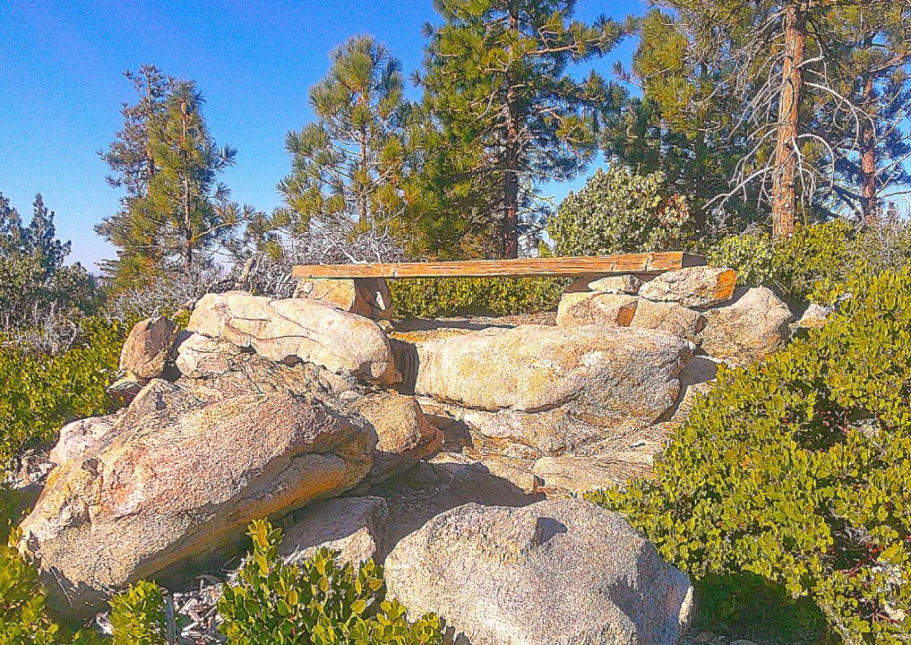
At the trail’s highest point, a beam placed on rock piles is a great place to sit for a while and savor the views encompassing more than 270 degrees.
At about the 0.7-mile mark of your hike, the trail almost touches the Forest Service road before becoming even narrower along a level stretch. Soon, though, you’ll be entering the steepest section of the route, which winds upward through copious stands of chaparral. In spots the manzanita and other shrubs threaten to overwhelm the pathway. Only persistent efforts by dedicated and diligent volunteers keep it open for hiking.
The aerobic challenge lasts for more than two-tenths of a mile. Finally, the path levels out and opens up into yet another sweeping buena vista. Not much farther on, you’ll arrive at a second open area by the roadway, where the upper trailhead is situated. You’ve been hiking for about one mile now.
Go left here along the path, which at one point almost disappears under a blanket of oak leaves and acorns. Proceed uphill to a clearing that represents the trail’s highest point and offers its most expansive view – a full 270 degrees, at least. A heavy wooden beam placed on two rock piles almost insists that you sit down for more than a few moments to enjoy this splendid setting.
Now you can retrace your steps or, if you choose, return via the Forest Service road. The former option is more scenic, of course. The round trip, including the initial dirt-road stretch from where you parked, is about 2.2 miles. As for tunnels, they’re underground constructions. So. the name of this trail remains a bit mysterious.
NOTES: This is not an easy trail to find, but it’s definitely worth the effort. From our part of the San Bernardino Mountains, it provides some of the most unimpeded and striking views of the San Gabriel Mountains. Silverwood Lake in the foreground is a “natural canvas” bonus. Situated on a ridgeline far from intrusive traffic, the trail is a serene hiking gem.





0 Comments