



By TIM WILCOX
Special to the Alpine Mountaineer
Where: Rimforest
Length: 3.2-mile loop
Elevation gain: 102 feet
Difficulty: easy
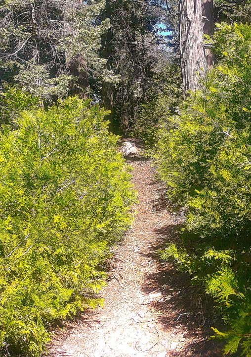
On the Enchanted Loop, young fir trees almost overwhelm the pathway. This trail extends for about half a mile, connecting with the much longer Dogwood Trail near its upper end.
Campgrounds are for camping. Yes, but they’re also good for hiking. As a prime example, consider a 200-acre U.S. Forest Service location with 94 campsites and two trails. It’s the Dogwood Campground.
There’s no parking for non-campers here. Instead, you’ll need to leave your vehicle on the side of the short access/egress road between Highway 18 and Daley Canyon Road. During the week it’s usually not hard to find a spot there, just steps from the campground entrance. On weekends, though, it can be a challenge.
FYI, we’ve heard various reports and rumors about when Dogwood will actually open for the season. Our best information is sometime between April 18 and 20. If you visit and the lower gate remains closed, you can still hike up into the campground. In some ways, quite frankly, the outing is more pleasant when Dogwood is vacant – more peaceful, at least. That said, it’s a more energetic and colorful venue when campers are present.

Lake Arrowhead resident Rick Gilbert is a long-distance cyclist who, on this occasion, was riding through the campground several times as a training session for a big upcoming adventure. On May 8 he’ll fly to France for an epic two-wheel challenge. Rick will begin cycling in Bordeaux, heading north along the Atlantic Coast. Then at Nantes he’ll head east along the Loire River until he reaches the celebrated Tour de Burgundy route. He estimates that the carefully planned itinerary will be “about 1,200 to 1,300 miles.” And how long will it take? “I won’t be on a tight schedule,” Rick says. “Some days I’ll do 50 miles, and other days I’ll be more relaxed.” In the past he’s cycled along the Danube and Rhine rivers, also in Europe, among other destinations.
On the road and trail
Once you’ve parked and locked your vehicle, head toward the nearby Forest Service sign and entryway gate. (Watch carefully for fast-moving traffic turning off of the highway en route to Agua Fria and Blue Jay.) Hike uphill for about half a mile past the check-in booth (for campers) and onto the grounds.
Dogwood is a maze of roads and campsites, so there’s no well-established hiking route. Your best bet, however, is to stay on the widest road and avoid wandering off onto the side streets. Initially, the campsites’ numeric posts are helpful guides. But they’re not in consistent order along the main route. One way to verify that you’re on an informal track is that it tends to have more of the large restroom stations.
To the right several tenths of a mile from the booth, you’ll catch a glimpse of the northern edge of Rim High School’s athletic field. It’s a reminder that civilization is maybe a little too close to the campground. The main road continues past site 35 and heads gradually uphill. Here the numeric posts are more consistent, evolving into the 40s.
Pay close attention to roadside views, which reveal that this is among the mountains’ most prolific forests. Especially striking are the thick stands of young fir trees.
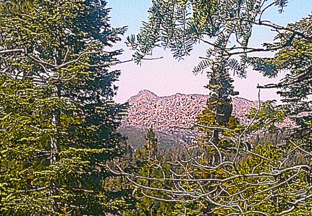
As you pass campsites in the 50s, the road narrows slightly and heads downhill. When you come to site 59, turn right and walk past the picnic table, then a small field of rocks. A few steps down the slope is a tree-shrouded view of The Pinnacles almost directly north.
Immediately beyond that site is a side road leading to the right. Take it, and you’ll come to the upper-level access/egress point for the Dogwood Trail (“Let’s Go Hiking,” Feb. 20). During warmer months, it’s the campground’s principal attraction for hikers. From this point, too, you can see a slice of Lake Arrowhead to the northeast. Another tenth of a mile or so brings you to a second trailhead, this one for the Enchanted Loop. It’s a pleasant, half-mile path, so why not take a quick break from the asphalt?
Finally, just past site 81, you’ll return to the main road. Arrows on the pavement and “EXIT” point the way for you to retrace the initial portion of your trek. Especially at sites 93 and 94, make sure to bear to the right. Soon, at about the 2.7-mile mark, you’ll revisit the check-in booth. Add another half mile as you walk downhill to your vehicle, and you’ll have completed an approximately 3.2-mile loop.
NOTES: One of the mountains’ largest and most-popular campgrounds is a pleasant destination for a 60- to 75-minute hike. The route we’ve detailed is a counterclockwise transit. That’s only a suggestion, of course. It’s fine and fun to be in “happy wanderer” mode.





0 Comments