



By TIM WILCOX
Special to the Alpine Mountaineer
Where: Lake Arrowhead
Length: 4.6-mile loop
Elevation gain: 422 feet
Challenge: easy to semi-difficult
When we visited Arrowhead Ridge in mid-March, its signature trail still bore signs of winter: snow, ice and muddy spots. Now, even in the wake of early-spring storms, the Will Abell Memorial Trail is a manageable and enjoyable “Let’s Go Hiking” destination.
Thanks to the extraordinary vision/commitment of the San Bernardino Mountains Land Trust, the trail is more than twice as long as its previous incarnation. Arrowhead Ridge itself is larger, too. In late 2021 the Land Trust bought an additional 94 acres, boosting the site’s acreage to 172.
The principal trail was named to honor Will Abell, a longtime, highly regarded Land Trust volunteer who died in 2012. A lifetime mountain resident and artist, he was a prime mover in scouting the trail’s initial route and actually building its first segment.
You’re probably already aware that Arrowhead Ridge is on Grass Valley Road across from the southern end of Lake Arrowhead Country Club (just north of Agua Fria). With an array of flags, the Lake Arrowhead Veterans Monument on site makes it easy to spot. Parking is somewhat haphazard in the large entryway but almost always available.
Once you’ve secured your vehicle, you’ll find the main trailhead just beyond the wide street leading up to the ridge itself. Obviously intended for motorized traffic, that ill-starred pavement has been a hikers-only passageway since the Land Trust took possession of the failed high-end residential development in 2011.
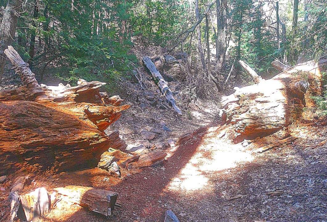
The trail passes through an opening between two sections of a giant sequoia that’s been decomposing on the forest floor for many decades.
On the trail and road
Narrow at the start, the trail winds upwards with quite a few twists and turns. Then it levels off and heads downhill into a more thickly forested section before proceeding uphill once again. At the 0.2-mile mark, the path widens noticeably, then returns to its narrow mode. Steps later you’ll come to a T-intersection, with the trail heading right.
Now the route passes through a forest dominated by evergreen trees, with oaks playing a minor arboreal role. On the right you’ll notice a pair of particularly prominent Ponderosa pines – one of them towering more than 120 feet.
Shortly thereafter, the trail transitions from moderately uphill to downright steep. Ahead is a fallen giant sequoia, which has been lying on the ground for decades. When alive and at its pre-tumble peak, this forest monarch must’ve boasted a base diameter approaching 10 feet. The trail passes through a chain-sawed opening in the tree’s midsection. At this point you’ve been hiking for 0.7 miles.
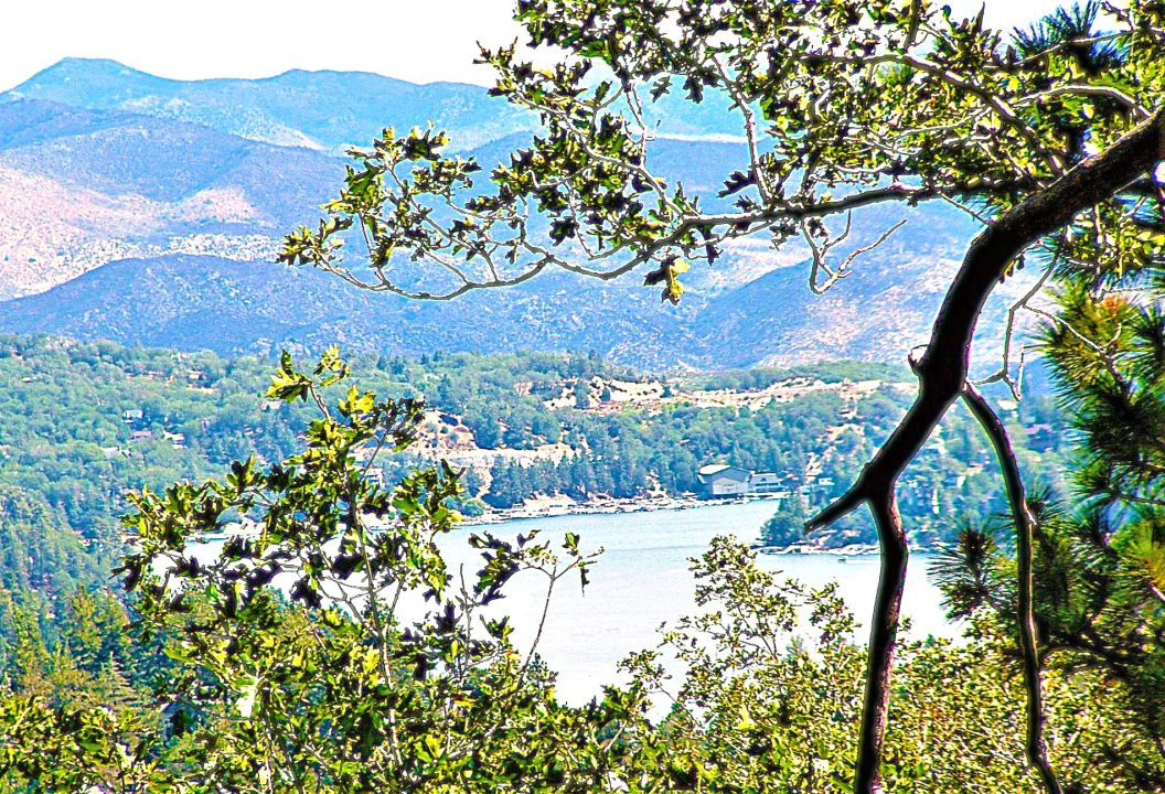
Soon you’ll enter a long stretch with several switchbacks. Then, exactly one mile into your outing, you’ll come to a kiosk with a graphic depicting Arrowhead Ridge and the expanded trail. On the kiosk’s flipside is interpretive text. To the right, a small wooden sign directs hikers to a viewpoint. Walk in that direction 100 yards or so, and you’ll arrive at the lookout. There’s Lake Arrowhead to the east – the view framed by oak and fir foliage.
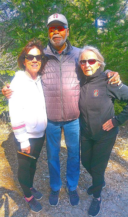
Susan Middleton (left) and Miguel and Hannah Osborne are frequent hikers along Old Toll Road. They live in Lake Arrowhead.
OK, return to the kiosk and head right down the main trail, which at this point is almost as wide as a small road. When you come to more signage with arrows, turn right and follow the relatively new Little Bear Loop. This 0.4-mile segment, which extends northeast and then north, leads to a T-intersection with another helpful schematic. Continue right again along what’s called the Old Toll Road Connector. The path heads downhill for a little ways to a short, even steeper access to the road itself.
Make yet another right turn onto Old Toll Road. It’s a wide and winding dirt route with many pools of water (snowmelt and rain) – some of them quite large. Fortunately, they’re easy to circumvent. This newest part of the trail was inaugurated a year ago. Views along the way are of surrounding hillsides and mountains to the east.
After several tenths of a mile, you’ll pass two boulders in the road. Now you’re nearing its terminus, which is marked by another boulder and a closed gate. Execute a U-turn there at 2.6 miles into your adventure.
Retrace your steps along Old Toll Road back to the connector segment. Proceed uphill to the kiosk and then straight ahead (due west) along a narrow and ascending path to the original trail. An arrow at this confluence points downhill. Retaining its narrow format, the route is marked by a series of sharp switchbacks. Then the path ascends briefly and levels off before rising once again.
Finally, you’ll arrive at a stairway of embedded logs that leads to the topmost trailhead and the main road of Arrowhead Ridge. Amble downhill along the pavement to the parking area. Now you’ve gained a step-by-step appreciation for the better-than-ever Will Abell Memorial Trail.
NOTES: The Land Trust continues its ambitious restoration of Arrowhead Ridge, including the significantly augmented and improved trail. The site’s combined pathways, including Old Toll Road, extend for 5.2 miles. Our suggested route covers 4.6 miles.





0 Comments