


By TIM WILCOX
Special to the Alpine Mountaineer
Where: Silverwood Lake
Length: 5.2-mile round trip (partial transit)
Elevation gain: 87 feet (return leg)
Challenge: easy
It’s one the longest and most well-known trails in the United States. The Pacific Crest Trail (PCT) extends 2,653 miles from the Washington State/Canada border to the California/Mexico border. Each year some 50,000 “thru hikers” trek the PCT’s entire length, typically in four to five months. Supremely fit and determined athletes have done it in as little as two months, averaging more than 40 miles per day. Amazing!
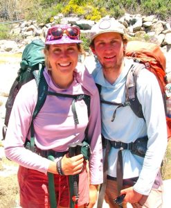
Less than two weeks into their early lifetime adventure, “thru hikers” Emma Vallon and Mel Geisler are trekking the trail’s entire 2,653-mile length. They’re from Whitefish, Montana.
Our “Let’s Go Hiking” destination this week is a four-mile section of the PCT in the Silverwood Lake State Recreation Area. (FYI, the trail meanders for many miles in or near the San Bernardino Mountains, much of it tracing the flow of Deep Creek.) To get there, start by finding your way to the main intersection in Crestline, by Lake Gregory and the recently reopened Goodwin’s market. Turn left at the stop sign and drive through town. When you begin going uphill, watch for the old white church on the right. Immediately beyond it and straight ahead is Knapps Cutoff. Follow the cutoff to a stop sign, which is the intersection with Highway 138.
Go straight, then downhill on the highway to another stop sign. Continue driving past the parking area for Heart Rock and gate to Camp Seely. Soon you’ll enter an exceptionally winding stretch of Highway 138 that leads sharply downhill to Silverwood Lake. About eight miles from the Crestline intersection, watch for a turnoff to the recreation area. When you reach a stop sign, turn left and motor about 0.3 miles to an office building and small lot. Park there for free. Now it’s time to go hiking!
On the Road and Trail
Return to the road, which is actually part of the PCT, and walk back toward the stop sign. On your left you’ll see Cleghorn Creek, which empties into Silverwood Lake. Near the stop sign where you turned, you’ll see a gate with a No Parking sign. That’s the understated entry point to your off-road hike.
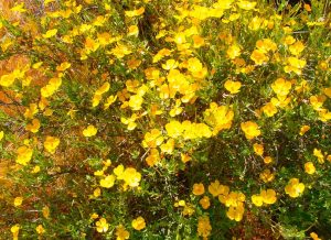
Spanish broom is widespread along some sections of Silverwood Lake’s slice of the PCT. Many people view this perennial evergreen shrub as invasive and unwelcome. Still, its brilliant yellow blossoms and sweet aroma have an undeniable appeal.
Somewhat surprisingly, the trail is paved with asphalt. About six feet wide, it heads slightly downhill for a short stretch, crosses another road and enters a grove of deciduous trees and hardy shrubs. Please note that this route is open to cyclists as well as hikers, so be especially alert around blind curves.
You won’t be blind to an unfortunate aspect of the path – namely, that in spots the pavement and perimeter rocks are defaced with graffiti. That’s unconscionable! As a balancing plus, litter is almost completely absent.
At the half-mile mark, the trail bisects a large meadow alive with springtime vegetation. It’s a refreshing change of scene. Then you’ll enter an ascending section that will amplify the aerobic benefits of your outing. A mostly level stretch, with alternating shade and full sun, follows. Another lovely meadow appears on the right. To this point there’s been no sign of the lake.
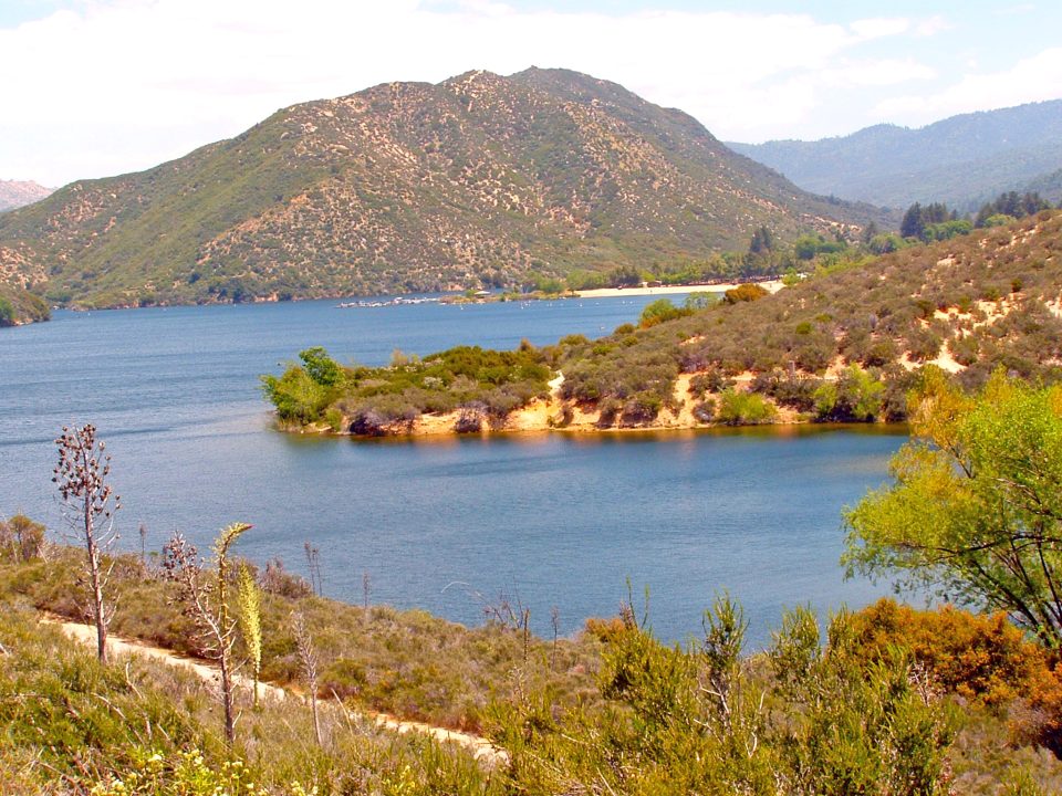
Now, nearing the one-mile mark, you’ll come to a campground. Also, to the left, you’ll catch your first glimpse of Silverwood. A wide turn to the right takes you past an imposing cypress, with a base diameter exceeding five feet, and leads to a T-intersection. Turn left there. Moments later, there it is: the 976-acre reservoir. In the near distance are the recreation area’s main beach and marina. Farther north and west, mountains supply the buena vista backdrop.
After you cross a large circle in the pavement, the trail proceeds downward, making another sharp turn and coming ever closer to the lake. Nearing water’s edge, the pavement widens with a concrete margin and rock piles on the left. Soon you’ll encounter several adobe-colored concrete benches bearing the state parks’ emblem. They invite hikers to take a moment’s rest and savor the views.
This is close to the trail’s two-mile point. Continue onward for another 15 or 20 minutes, and you’ll arrive at the main beach and the 2.6-mile mark – almost exactly two-thirds of Silverwood Lake’s stretch of the PCT. It’s an agreeable place to begin retracing your steps, resulting in a 5.2-mile round trip. Of course, if you’re feeling particularly ambitious, hike on to the four-mile endpoint, then return. Either way, you’ll have enjoyed a mere taste of a world-class trail. Let’s be candid and admit that rather than a “partial transit,” it’s a “micro transit.”
NOTES: The recreation area’s main lot, primarily for visitors headed for the beach, marina or campground, charges a $10 parking fee. It’s smarter, then, to leave your vehicle at the much smaller office parking lot, which is free. Silverwood Lake’s elevation is 3,356 feet, which means that temperatures are usually warmer there than higher in the mountains. Much of the trail is without shade, so a hat and sunscreen are recommended.




0 Comments