




By RHEA-FRANCES TETLEY
Historian
As the United States was declaring its independence from England in 1776, Father Francisco Tomas H. Garces was exploring the Inland Empire of California. He was searching for a route from New Spain, where the mission San Xavier del Bac (near present day Tucson, Ariz.) was located, to the California missions along the Pacific coastline.
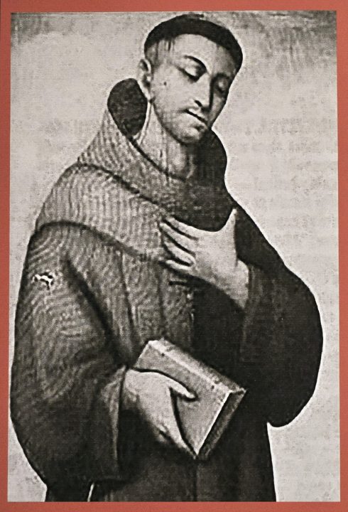
The poster in the Mountain History Museum about Father Garces’ visit to the San Bernardino Mountains in 1776.
Fr. Garces was looking for locations across the desert from Arizona to California to build missions intended to connect the missions for trading and supply purposes for the Spanish. He made five trips during a 13-year period. Fr. Garces kept detailed journals of his travels and discoveries.
Fr. Garces first entered California in 1771, following the Gila River downstream, looking for the Colorado River. He crossed the desert and saw the San Bernardino Mountains far in the distance but returned home. Captain Juan Bautista De Anza hired Fr. Garces as a guide for his expedition across the Colorado River and into the California desert in 1774. Fr. Garces again helped De Anza in 1775 and then left that expedition to do his own exploring along the Colorado River.
Early in 1776, Fr. Garces went north from the Colorado River and met a tribe of Mohave Indians, near where Needles is located. He called them “Jamajabs.” They knew of a trail across the Mojave Desert toward the mountains he had seen in 1771. Five members of the Jamajab tribe led him to a full Soda Lake, which is fed by the Mojave River that flows down from the San Bernardino Mountains.
Fr. Garces named the river-fed Soda Lake the “Arroyo de los Martires” (Martyrs) on March 9, 1776. He followed what is now known as the Mojave River for several weeks, discovering the river’s source. He then followed the Mojave River Indian trail up the ridges, to the top of the mountains, on the west end of the San Bernardino Mountains.
On March 22, 1776, Fr. Garces saw the massive San Bernardino Valley and the Pacific Ocean from what is now known as Monument Peak in Cedarpines Park. He wrote in his journal, “After three leagues, I crossed the (San Bernardino) mountain range. The trees mentioned yesterday reached to its top (Monument Peak), whence I saw clearly the sea (Pacific Ocean), the Rio de Santa Ana (Santa Ana River) and the Valle de San Joseph (San Bernardino Valley).” That sight encouraged Garces that he was nearly to the San Gabriel Mission.
Fr. Garces descended the mountain on the ridge between Devils Canyon and Cable Canyon, where his journal mentioned there were few trees on the southern slope. He arrived at an Indian village at the base of the mountain, near Cajon and Cable Creeks, and was warmly greeted. Within two days, he was at the Mission San Gabriel meeting some friendly Indians who had just visited the mission.
After a brief stay at the mission, he continued north over the Tehachapi Mountains into the San Joaquin Valley. While returning to Arizona, Fr. Garces discovered some unfriendly Hopi Indians. This was surprising to him as most Indians were receptive to him.
Five years later, in 1781, while exploring Yuma Indian lands, Fr. Garces was killed. This caused the Sonoran Trail, opened by Fr. Garces, to be abandoned by the Spanish. The missions the Spanish had intended to be built along that route, originally scouted by Fr. Garces, were never built.
West of Cedarpines Park, in 1931. the San Bernardino County Historical Society placed a historical marker on the hilltop, naming Monument Peak, thus honoring the spot where Fr. Garces first saw the Pacific Ocean.




0 Comments