


By TIM WILCOX
Special to the Alpine Mountaineer
Where: East of Running Springs
Length: 2 miles
Elevation gain: 114 feet
Challenge: easy to moderate
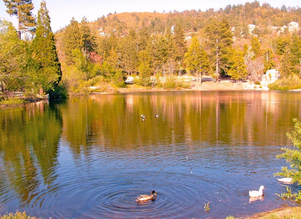
Small Is Beautiful was a popular and influential book published in 1973. Its title could apply to Arrowbear Lake, so named because it’s approximately halfway between Lake Arrowhead and Big Bear Lake. At less than four acres, it’s one of the mountains’ smallest bodies of water. But, when full, it can be quite beautiful – especially on a delightful springtime morning, afternoon or evening. And while you can’t walk around the lake, you can hike along nearby roads in this alpine hamlet.
First, some directions. . . Travel to Running Springs on Highway 18. From the main intersection (at Highway 330), continue east for about two miles to Arrowbear Drive (just before Victoria’s Family Restaurant). Turn right and proceed a short distance until you come to a bridge. Turn right again, crossing the bridge, then immediately left onto a parking area at lake’s edge. All right, let’s go hiking!
On the Road
Recross the bridge on foot. When you do so, you’re walking on top of the lake’s dam. Turn right at the stop sign, and you’ll be on Sierra View Drive. The road here follows the shoreline for a short stretch with striking rock formations on the left. Some homes cozy up to the boulders and even perch on top of them. You’ll also notice a sign that reads: “Arrowbear Lake, Population 736, Elevation 6,220 feet.”

Monumental rock formations are common in this area, and some homes are situated near or even on them.
Sierra View turns sharply right at about the 0.2-mile mark. Instead, amble straight ahead onto Music Camp Road. This stretch heads uphill for several tenths of a mile through a neighborhood of rustic, unassuming homes. You may encounter some of the owners, who’ll likely share a friendly greeting. Dogs along the way are less cordial though not running loose.
About half a mile from where you parked, the road looks east, encompassing mountains en route to the Snow Valley ski area and ultimately Big Bear Lake. On the right you’ll see more rock formations above a small canyon in the direction of Keller Peak to the west.

At Arrowbear Lake’s western end, the feeder creek creates a five-foot waterfall as it spills over a mossy wall into the lake.
Just past Cedar Drive on the left, Music Camp Road goes downhill through a neighborhood of small, closely set houses. When you come to a large black-on-yellow arrow, near the intersection of Cedar and Sierra View, walk a little farther until you arrive at a dirt road. Head down there toward the lake. Proceed to water’s edge, then walk left to a group of boulders. Step over them carefully and through a thicket of small trees. Now you’ll be on what looks like a large beach, though there’s no visible public access. Less than 30 feet away, the lake’s feeder creek spills over a mossy concrete wall creating a mini-waterfall. That stream and the lake are part of the extensive Deep Creek watershed.
OK, retrace your steps through the thicket and over the boulders. Stick to the shoreline along the beaten-earth path until you come to Sierra View. Turn left, then left again over the bridge, passing your vehicle. Here you’re following Arrowbear Drive.
Walk past the community park, with its ballfield and playground, into yet another neighborhood. On the left you’ll see an oak tree with a common base and five separate trunks. That’s unusual. At about the 1.5-mile mark, turn left on Oak Drive. Then, a hundred yards or so farther, turn left on Ridge Drive, which leads to Fir Drive. Turn left again and hike downhill for a ways, past the Arrowbear Park County Water District office. Make yet another left turn onto Lakeview Drive, which will take you along the shoreline back to your vehicle. Now you’ve completed a two-mile initial tour of Arrowbear Lake’s neighborhoods. If you return at some point, take a different route.
NOTES: Spring is the best season to visit this tiny body of water, when it’s full and the weather’s fine. Because there’s a network of streets in the area, you can create several different hiking itineraries. Consistently, though, the “small is beautiful” lake serves as your beginning and ending focal point. By the way, if you pass the intersection of Lake Arrowhead’s Kuffel Canyon Road with Highway 18, consider taking a short detour. Why? Because you’ll be treated to a spectacular display of Pacific dogwoods in full “faux blossom.”





0 Comments