



By TIM WILCOX
Special to the Alpine Mountaineer
Where: Lake Arrowhead
Length: 2.3 miles (with alternative return leg)
Elevation gain: 112 feet (final stretch of outgoing leg)
Challenge: easy to moderate
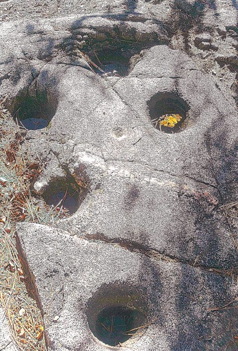
The far northwestern quadrant of greater Lake Arrowhead is home to a pair of especially well-known trails: The Pinnacles and Deep Creek. A third route, Pilot Rock, is less prominent. Then there’s the Metate Trail. Although this is the area’s low-profile hiking destination, in historic and ethnographic terms it’s more significant than its three neighbors.
So how does one get there? Motor north on Highway 173 beyond its intersection with North Bay Road. (FYI, Caltrans doesn’t remove snow from the highway after Arbon Lane.) Just past the turnoff to Deer Lodge Park, approximately eight miles from Lake Arrowhead Village, look for the Metate Trailhead parking area. Secure your vehicle there, then walk across the highway into the Forest Service Rock Camp. Head right until the pavement gives way to a dirt road. Follow it to a barely legible sign reading, “INTERPRETIVE AREA.” Two wooden posts mark the actual trailhead.
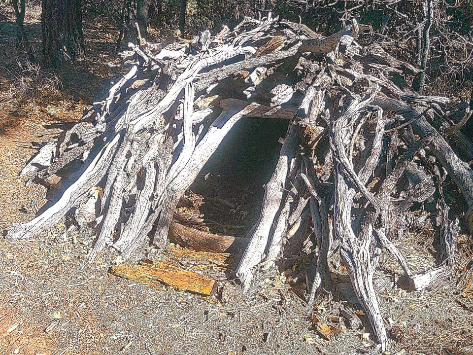
Next to the main metate field, a shelter made from tree limbs is either a demonstration project or a faux relic. It’s definitely not a structure erected by the Serrano in the 18th or 19th century.
On the trail
Initially as you hike east, the beaten-earth pathway is wide and level with almost no rocks or small boulders. Oaks, pines, firs and chaparral populate this lightly forested area. About one-third of a mile from where you parked, you’ll arrive at a fork in the trail. Go right past a large fallen tree and proceed gently downhill to a rough-hewn bench.
Walk a few more steps, and you’ll encounter a stone-and-mortar monument on the left bearing a weathered bronze plaque. It reads: “INDIAN ROCK CAMP. In memory of the desert Indians who came here every fall for many years to grind their acorns in the many metates among the rocks.” This monument was dedicated by the Woman’s Club of Lake Arrowhead on March 15, 1938.
Surprisingly and unfortunately, it’s the only interpretive element in this key spot and along the entire trail. Online, however, the Forest Service shares this information: “The Serrano came to this area. . .because of the plentiful acorn crop and the mild weather. Bedrock mortars were formed by the grinding action of mono and pestle stones. It was much easier to use these large bedrock slabs rather than carry a mortar stone with them, but they also did that in areas where such stones did not exist.” The time frame is quite broad: the 18th and 19th centuries.
Because the main metate (meh-TAH-tay) viewing area is behind the monument and some thick shrubbery, it’s often missed by hikers who continue straight ahead. Instead, step to the left of that sign and into a sheltered glen to view the namesake bowls hollowed out in the granite substrate of relatively flat, ground-level boulders. Nearby you’ll see a wigwam-like structure made completely of various-sized tree limbs. It’s either a demonstration project of some sort or a faux relic rather than an authentic shelter erected by the Serrano. Such a construct would never survive 150+ years of snowfall.
OK, return to the durable stone marker and head left down the trail to another fork. Go left there and pass by impressive stands of manzanita to even more metates. After ambling by an expansive meadowland, you’ll encounter a field of boulders and a dry creek. Traverse the streambed, then climb the slope back onto the trail’s extension.
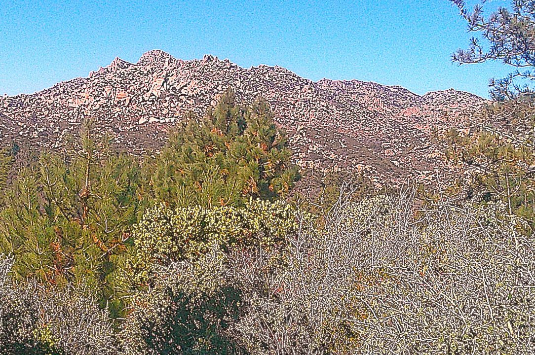
From an expansive opening near the trail’s highest point, hikers can view The Pinnacles some two miles to the northwest.
At yet another fork, turn to the left. Soon you’ll come to a fallen oak with bare branches reaching across the pathway. A few steps farther, and what’s been a mostly level trail becomes quite steep in spots. Wind your way uphill and walk between two sentinel oaks. Finally, at slightly less than a mile from your parking spot, you’ll come to a level open space with a 180° view starring The Pinnacles to the northwest.
The pathway continues its ascent and narrows to about one foot in spots. Then, when you step into yet another wide-open area, you’ll be treated to views of mountains to the east and northeast. Here, at about the 1.1-mile mark, the trail shifts downwards. It’s a good place to begin the return leg of your hike.
Now you can wander a bit and explore some of the optional, less-traveled forks instead of retracing your steps. It’s a maze, for sure, but that adds interest and challenge to your hike.
Here’s an example: Go back to the pond and creek, then launch a different return route by taking the pathway steps beyond to the right. This offshoot meanders gently downhill past quite a few downed trees, which could be the remnants of a severe wind-and-ice event many years ago.
You’ll pass a rocky ravine on the right before entering an ascending section of the path. Unless you want to take a lengthy detour, though, ignore even more offshoots to the right. Finally, you’ll arrive at the trail’s first fork, just above the metates. A right turn here leads back to the wooden posts and, not far beyond, the parking area.
Depending on your pace and how far afield you wander on the ancillary paths, you’ve been hiking for anywhere between 45 and 90 minutes. Typically, though, this is a one-hour adventure.
NOTES: This lightly traversed trail leads to a close-up view of precious Native American artifacts dating to the 18th and 19th centuries. Because it’s far removed from any flow of traffic, the route offers a refreshingly peaceful hike. That said, this is mountain lion territory. Don’t visit at dusk and certainly not after dark. Even in broad daylight, it’s always wise to carry a canister of bear spray or mace. The chances of encountering a mountain lion – or a bear, for that matter – are slim. Still, why not honor the Boy Scout motto?





0 Comments