



By TIM WILCOX
Special to the Alpine Mountaineer
Where: Lake Arrowhead
Length: 2.3 miles (round trip)
Elevation gain: 248 feet
Challenge: easy to moderate
It’s the crown jewel of the San Bernardino Mountains Land Trust. Arrowhead Ridge was once a high-end residential development. It failed before any foundations were laid or homes built, languishing for a while in stark and sad incompletion. Then, in 2011, the Land Trust purchased 80 acres from the developers and began painstaking restoration of the site.
Twelve years later, the nonprofit bought an additional 94 acres. Today, this expanded and ambitious project continues – highlighted by robust regrowth of trees and shrubs in the unfortunately and unwisely invaded forest.
The main hiking attraction here is the Will Abell Memorial Trail, which in 2023 was more than doubled to 5.2 miles. On the cusp of winter and spring, this winding, often steep pathway is snowy and icy. (It’s not a congenial route even for snowshoe enthusiasts.) In a few weeks, however, it’ll be much more manageable. All of that said, you can still hike on this protected parcel.
First, though, a reminder of how to locate Arrowhead Ridge. It’s on Grass Valley Road across from the southern end of Lake Arrowhead Country Club (just north of Agua Fria). Thanks to the flag-festooned Lake Arrowhead Veterans Memorial on the premises, it’s easy to spot. Informal, somewhat haphazard parking is available by the gate, not far from the monument. Your initial foray lies ahead: the hapless development’s main street.
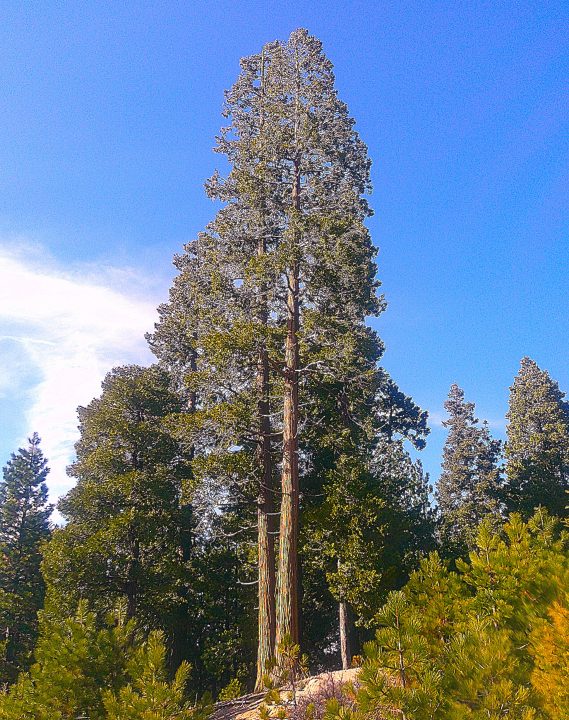
Rooted close together, sibling sequoias compete to surpass a height of 120 feet.
On the road and trail
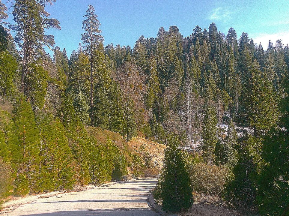
The principal road ascending to the ridgeline is steep and wide. Along with the asphalt, the most visible signs of the ghostly development are abandoned concrete conduit sections – unsettling reminders of dashed infrastructure plans. Still, the acreage is largely free of such unsightly debris, which is a tribute to the Land Trust’s massive effort.
Toward the top of the hill, you’ll see a sign that reads, “TRAIL,” with an arrow pointing to the right. That’s one of two upper Will Abell access points. The lower trailhead is in the parking area.
Anyway, the main street continues uphill on a much more moderate incline. Then, when you level off about one-third of a mile from your starting point, you’ll come to a side street, which ends abruptly. Turn right there immediately past another trailhead sign, then veer slightly to the left. Look for an opening between adolescent evergreens and climb up that short, rocky incline onto the namesake ridge. FYI, snow accumulation and retention are less of a problem here, where trees are more widely spaced, allowing the sun to shine through and warm the pathway. For obvious reasons, snow on the road itself melts even more quickly.
Turn right again and hike uphill. Although this isn’t a carefully marked trail like Will Abell, you’ll sense that it’s an intentional path winding among the trees. The forest here is healthy but not overly thick. Naturally, conifers predominate.
The mostly narrow pathway ascends gently. Pause at a large clearing to take in westward views of Strawberry Peak and hills above the golf course, then follow the meandering mini-trail until it reaches its highest point on the ridge. Suddenly, it becomes wider and shifts dramatically downward. (If snow has recently accumulated here, honor caution and make a U-turn.) Continue past a dirt road on the right. A few paces beyond that point, you’ll encounter a wider dirt road and large turnaround.
Hiking past both, you’ll come to street signs marking the intersection of Golf Course Road and Old Toll Road. (The latter is now part of the site’s main trail.) This is your outward-bound endpoint. Now it’s time to retrace your steps back up to the ridgeline, down to the side street and finally onto the main road.
Amble downhill to the parking area, turn right at the gate and walk to the veterans memorial for a moment of quiet and respectful reflection. Completed in 2015, this is an impressive monument thanks to high-grade stonework plus black-marble benches bearing the insignias and mottos of the primary military branches. Overhead the service banners flutter proudly in the company of the U.S. and California flags. It’s a fitting and moving salute to our honored and honorable veterans.
NOTES: This is a short foray that combines hiking up a steep roadway with walking along a narrow alpine ridge. In warmer months it plays second fiddle to the Will Abell Memorial Trail, which is the No. 1 on-site attraction for hikers. But in winter and early spring, the ascendant road and ridgeline path are much easier to traverse and provide a vigorous workout. The Lake Arrowhead Veterans Memorial is an inspirational bonus.
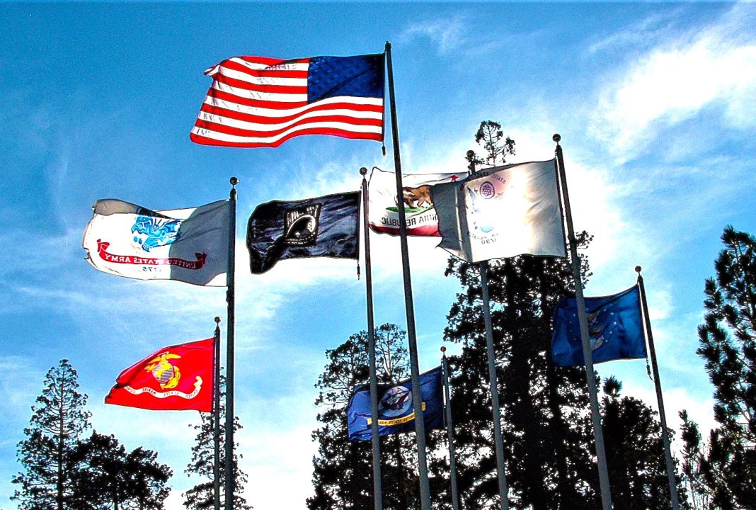
At the Lake Arrowhead Veterans Memorial, the national and state flags fly overhead with banners of the U.S. military branches. The memorial’s front-and-center inscription reads, “THIS MONUMENT IS DEDICATED TO ALL VETERANS PAST, PRESENT AND FUTURE.”





0 Comments