




By RHEA-FRANCES TETLEY
Historian
Snowstorms are the exact reason why the Rim of the World High Gear Road, when it was reconstructed in the late 1920s to mid-1930s, was relocated onto the south face of the mountain. It was built there to allow the snow to melt from sunshine.
It’s important to remember that private ownership of autos in the mid-1920s was still a relatively new concept, as motorized vehicles had only been commonplace for about 15 years. The dirt surface of the Rim of the World Road had only opened to automobile traffic in 1915 and later the surface was oiled. The idea of a “self-melting” south-facing road sounded great and worked well enough because small snowfall amounts were often followed by warmer weather and sunshine.
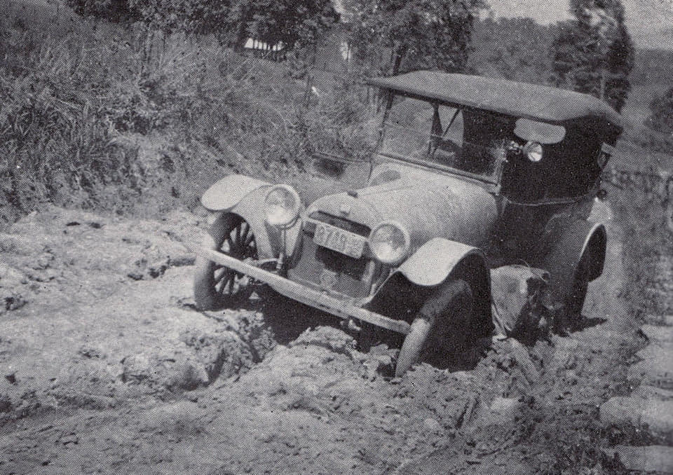
A car on the muddy Rim of the World roadway.
Of course, later on plows would be needed on paved roads when it snowed several days in a row and it didn’t melt quickly, especially at the higher altitudes. But winter populations were small and travel not common in snow.
The Rim of the World Road was realigned in many places along the rim during the construction of the paved High Gear Road, which was completed in the 1930s. The realignments were necessary for widening the road and reducing the grade to only 6 to 8 percent so cars could travel uphill in high gear. The realignment eliminated many sharp curves and made it possible to have much of the road with southern exposure, for better snowmelts.
The first place the roadway was relocated on the western end was just past the spot where the California Department of Highways maintenance station would be located at Panorama Point. That maintenance station, built during construction of the two-lane High Gear Road, was burned during the 2003 Old Fire and has since been removed.
Prior to the construction of the High Gear Road, the oiled dirt Rim of the World Road, with its 13 switchbacks, climbed the steep face of Waterman Canyon and reached the crest near where St. Frances X. Cabrini Catholic Church is now located. The Rim of the World Drive then ran along what became Crest Forest Drive, through Crestline and continued eastward to Arrowhead Highlands. There the road traveled past the Squirrel Inn to Pinecrest.
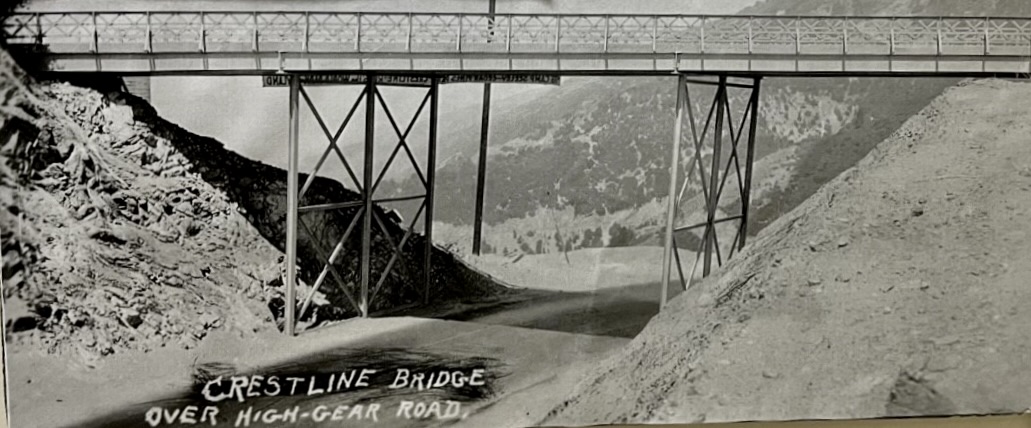
The train trestle bridge at Mt. Andresen built for auto use to connect Crestline with the new High Gear Road.
Then the road went through Pinecrest and its stone pillars on the right side of the current road and over to the crest below Strawberry Peak. This is where the dedication monument of the 1915 ROW Drive was located. There, the road went out to the crest again just west of Rimforest.
In the mid-1920s the new realigned High Gear automobile route started at Panorama Point and continued eastward along the south face of the mountain below Skyland. A new connection road to Crestline was created, cut into the west hillside of Skyland, beginning at the point where the former incline railway crossed the new High Gear Road route. To create that Crestline access road at less than an 8-percent grade required a bridge, using a metal one-lane train trestle as the bridge, with a stop sign on each end. The road encircled Mt Andresen to gain elevation to connect to the High Gear Road. That road was rebuilt in the 1960s as Highway 138.
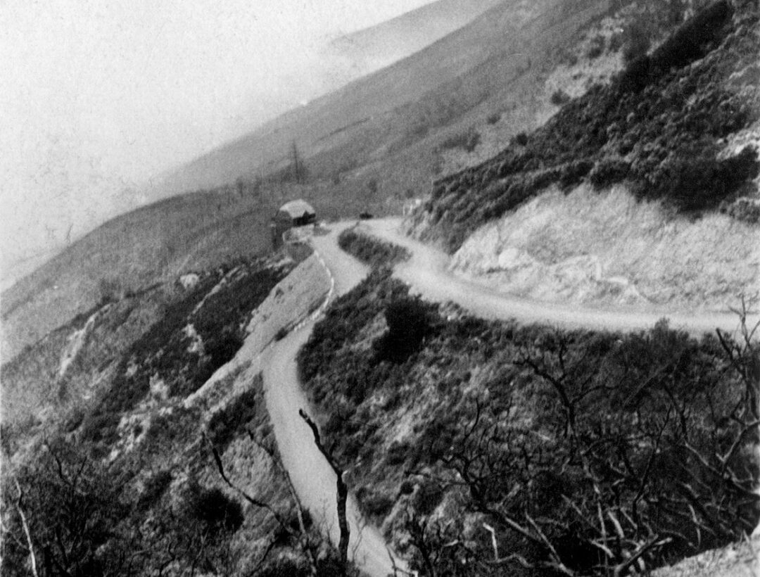
Panorama Point with the maintenance station when the roadway was only two lanes.
The High Gear Road was cut into the granite across the south face of the mountain to Arrowhead Highlands, east from the new Mt. Andresen Bridge, using techniques learned while making the Deep Creek Cutoff. At the time this cut into the sheer rock face of the mountain was considered a great engineering feat, allowing vehicles to travel 20 to 25-MPH in that section now called the Crestline Narrows.
The High Gear Road continued across the south face, past where Baylis Park is now located, and connected to the old road west of Rimforest, continuing along the south face of the original 1915 Rim Road constructed through to Skyforest and on to Running Springs, then through the Deep Creek Cutoff to Big Bear Valley.
The construction of the High Gear Road in the 1920s changed the purpose of the mountains. The developers were selling lots for vacation cabins all over the mountain, knowing the High Gear Road would result in easier auto access and would bring more customers, residents and vacationers. It would have if the Great Depression hadn’t hit. But having a road designed and already under construction gave those in the Civilian Conservation Corps (CCC) and the Works Progress Administration (WPA) jobs to complete the roads, introducing them to the mountain. Many of those workers returned after World War II to purchase vacation homes.
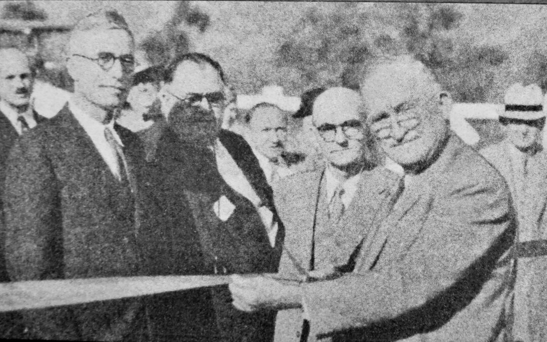
The ribbon cutting on the High Gear Road in 1933 by California Highway Commissioner Frank A. Tetley Sr.



0 Comments