

By TIM WILCOX
Special to the Alpine Mountaineer
Where: Running Springs/Arrowbear
Length: 4.6 miles (round trip)
Elevation gain: 732 feet
Challenge: moderate to semi-difficult
Here’s another hiking destination with a long name: Children’s Forest Exploration Trail. In this case, it’s also a long route: 4.5 miles with an elevation gain of approximately 1,500 feet. Nine miles is the round-trip total. That’s a bit much unless you’re an especially ambitious hiker. Also, because Keller Peak Road is currently closed, you can’t drive to the upper trailhead and take the downward pathway. Of course, you’d need a designated driver to meet you at the trail’s terminus. So for now let’s focus on the route’s lower half.
Here’s how to get there: From communities west of Running Springs, take Highway 18 east through Skyforest, then past SkyPark and Heaps Peak Arboretum. Motoring slightly less than five miles from the arboretum will bring you to “downtown” Running Springs. Proceed to the main intersection and remain on Highway 18 after passing safely through the yield sign. Continue down the hill a mile or so past Charles Hoffman Elementary School and its sports field to Keller Peak Road (just beyond the Forest Service sign). Two obstructions signal that the road is closed but allow you to pass through to its short, initial section. “No Parking” signs are absent there, so find a spot along the margin. This seems to be a common practice when the full road is closed.
On the trail
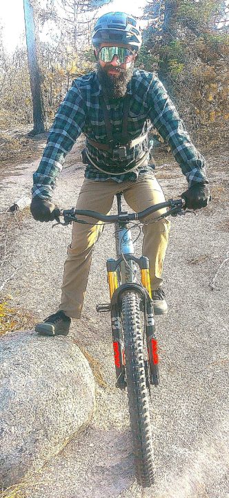
Crestline resident Travis Troupe is an expert mountain biker who visits the Exploration Trail about once a month. He’d taken Keller Peak Road all the way to the summit, then returned down the trail itself. At this point Travis had covered 12 miles with quite a few more to go.
Walk around the Forest Service gate and up the pavement until you come to a pair of parking spots. This is the lower trailhead. Turn right and pause for a moment by the welcome sign to take in a trail précis. Now head up the narrow pathway, which winds along the course of aptly named Dry Creek. When you arrive at a fork in the trail, head down to the right, walk across the creek bed, then follow the pathway briefly to the right before it turns left. After a semi-steep stretch, you’ll enter the first of many boulder fields – hallmarks of the Exploration Trail.
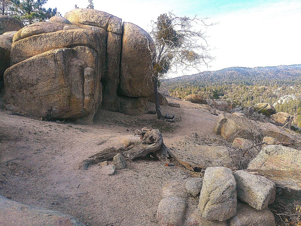
Soon you’ll pass one of the largest boulders on the entire route. It’s easily the size of a train locomotive. Soon the pathway becomes steeper and rockier, with pines, firs and hardy shrubs predominating.
At about the 0.6-mile mark, the trail widens and leads you downhill through a large open space. To the left is the wide and shallow creek bed. Head uphill once again until you come to a Forest Service road. Cross it and continue on the trail, past the one-mile mark of your outing. Manzanita grows in abundance here, and large cones on the path signal the presence of sugar pines.
A particularly rocky section ahead, with many loose stones, calls for careful hiking. This stretch, too, shows signs of becoming a mini-stream during times of a rainfall. To the right you’ll discover an interpretive post with a pine-cone symbol on its angled top. There’s no text, however.
Now the pathway oscillates from narrow to wide and back again. When you reach an intersection of Forest Service roads, bear right for a few steps until you see the trail’s somewhat hidden extension. Moments later you’ll come to an unexpected sight: a large open area that was recently bulldozed. Why? To prevent the spread of the Line Fire. Some of the trees and shrubs left standing are clearly singed. As you head up the trail, the damage becomes even more apparent. This was definitely a wildfire battle zone!
A little farther on, you’ll be treated to stirring views of rocky hillsides and mountains to the east. Then, not much farther, turn around and savor a vista comprising Strawberry Peak and, in the western distance, the San Gabriel Mountains. A few minutes later, Keller Peak appears straight ahead, revealing its own Line Fire scars. Sadly, the historic lookout on the summit was lost in the conflagration.
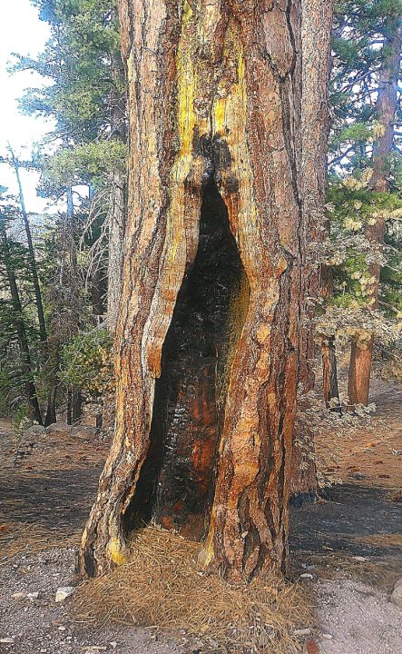
This seven-foot cavity in what appears to be at least a 200-year-old Ponderosa pine was inflicted by the Line Fire.
At the 1.7-mile mark, the most dramatic evidence of the raging fire appears on the trail’s left margin: a stately Ponderosa pine with a seven-foot burned-out cavity in its foundation trunk. This forest monarch will survive.
Proceed on the trail for slightly more than half a mile, hiking past additional charred trees and shrubs. In spots the boulders themselves are covered with soot. Here the route is quite steep in spots. Finally, when you encounter two huge boulders leaning on each other, with a teepee-shaped opening between them, you’ve reached the 2.3-mile mark. Now it’s time to turn around and retrace your steps, gliding downhill gracefully most of the way.
Just before the final half-mile or so, look for a relatively new memorial bench above the trail a few feet on the left. Its prominent inscription reads, “In memory of Gary Brandenburg. DEDICATED TO THE CHILDREN.” You’ve now hiked for about four miles, so reward yourself with a break there, then amble back to your starting point.
NOTES: The Exploration Trail’s lower half winds its way through several ecosystems, including chaparral and alpine forest. Steep in some spots, it’s a mostly open route with a few shady stretches. The round trip of about 4.6 miles should require about two and one-half hours of hiking.




0 Comments