

By TIM WILCOX
Special to the Alpine Mountaineer
Where: Lake Arrowhead
Length: 3.1-mile loop
Elevation gain: 195 feet
Challenge: easy to moderate
One of our favorite multi-surface hikes pairs MacKay Park with the North Shore Campground. When it comes to public places, MacKay boasts the best “from above” views of Lake Arrowhead. And especially when it’s closed for the season, the campground invites a peaceful passage leading to the North Shore Trail (“Let’s Go Hiking,” Dec. 19, 2024).
MacKay Park, as you probably know, is immediately southeast of Mountains Community Hospital. Secure your vehicle in the large lot there, then launch your hike by heading out along the pathway beyond the restrooms. A few steps farther, and you’ll come to a plaque bearing this solemn message: “In memory of Audrey MacKay, longtime Lake Arrowhead resident and supporter, and her grandson, Deputy Sheriff Jeremiah MacKay, who gave his life protecting the people of San Bernardino County.”
Downward to the left as you proceed is 18-acre Papoose Lake with the main dam (1977) on its eastern edge and the old dam (1922) under the roadway to the west. Significantly, these two barriers make 780-acre Lake Arrowhead one of the few places in the world with two functioning dams in such close proximity. (Lake Gregory is another.)
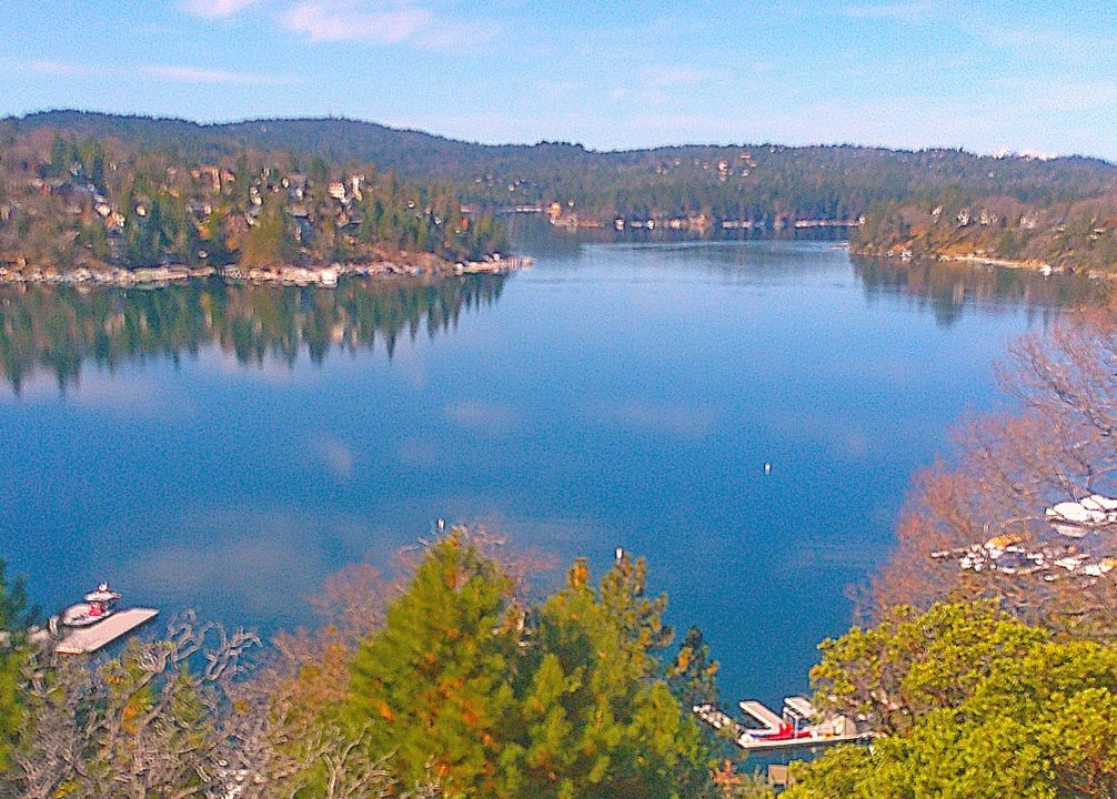
Farther on, past the zip line, playground and covered picnic area, is a deck that provides some of our area’s most expansive views of Lake Arrowhead. Linger there for a few minutes to savor the buena vistas. Now head back along the pathway to the parking lot and out through MacKay’s main entrance.
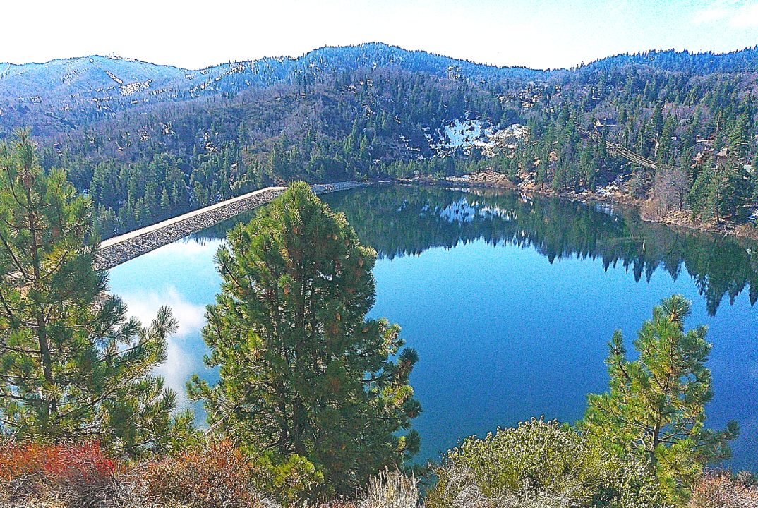
Closed to the public, much smaller Papoose Lake is backed up by the Audrey MacKay Dam (left). During fire outbreaks in the mountains, 18-acre Papoose is a prime destination for water-dropping helicopters in “emergency resupply” mode.
On the road and trail
Bear left on the road and head toward the hospital. Walk for some three-tenths of a mile, watching for oncoming traffic. You’ll pass through an open gate and continue upwards by the hospital’s parking lot.
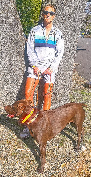
Pausing for a moment in the heart of the North Shore Campground, Kristin Corbett and Onyx (a German Shorthaired Pointer) are poised to continue their late-afternoon outing. A lifelong Lake Arrowhead resident, Kristin is an avid hiker and mountain biker who’s ventured all over the San Bernardino Mountains.
As you come to a crest where there should be a stop sign, look for the official North Shore Campground sign and, less than 30 paces farther, a “closed for the season” gate. Walk around that gate and head up the road into the deserted campground. Savor the alpine serenity!
When you come to a fork, bear left and amble on a few steps to the point where arrows begin pointing left. Follow them up to the highest level of the campground, where the pavement ends. Ahead is a Forest Service road that passes through a damaged gate and continues up the hill for one-tenth of a mile. Unfortunately, that unsecured opening gives ATVs and dirt bikes access to what should be a closed site. Candidly, this is a longtime Forest Service faux pas.
Anyway, proceed up the heavily rutted road until it intersects with another Forest Service route – Old Sawmill Road. If you were to continue left there, you could extend your hike for several miles. Instead, pause to take in the views from this vantage, then head back down into the campground.
On the pavement again, stroll past sturdy manzanitas. When you come to a restroom, turn left and plod on until you reach the entry point for the North Shore National Recreation Trail. That title, as we’ve noted, is a bit pretentious, and most hikers simply call it the North Shore Trail.
Now, for the next two-tenths of a mile or so, trace this narrow route, which observes a steep drop. When you come to Rouse Ranch Road (“Let’s Go Hiking,” Feb. 27), cross it onto the trail’s momentarily wide extension and proceed downhill for half a mile. You won’t be traversing the entire route by any means. Still, you’ll be hiking farther into the wilderness and augmenting your adventure. Thanks to our stormy March, Little Bear Creek is flowing parallel to the path.
OK, when you reach a segment with small boulders on both sides and a tall dead tree (“snag”) immediately to the left, perform a U-turn and retrace your steps to the road. Turn left and head uphill. Soon you’ll see a looming, somewhat invasive sign of encroaching civilization. It’s Lake Arrowhead Community Services District’s corporate yard. (On a positive note, this relatively new facility’s overall design, including a red-and-gray exterior color scheme, is surprisingly tasteful.)
Turn right and follow the pavement for three-tenths of a mile. Minutes later you’re back where you began – in Lake Arrowhead’s one and only public park.
NOTES: This is an easy-to-moderate pathway/road/trail hike that offers delightful lake and mountain views. The section through the North Shore Campground, still weeks from opening, is peaceful. MacKay Park itself is usually busy during daylight hours. Expect this outing to last from 75 to 90 minutes.




0 Comments