



By TIM WILCOX
Special to the Alpine Mountaineer
Where: northwestern outskirts of Lake Arrowhead
Length: 4.4 miles (round trip)
Elevation gain: 1,042 feet
Challenge: moderate to difficult
This is one of our mountains’ most challenging and significant hikes. Surpassing 1,000 feet from its starting point and winding around and over myriad boulders, The Pinnacles Trail is worth visiting again and again. Because the setting is more high desert than forested mountain, it offers a refreshingly different outdoor experience. During summertime, this shadeless route is too hot for a comfortable transit. Also, the danger of unwelcome rattlesnake encounters is much higher. So unless you have a strong preference for toasty, now’s a great time to visit. That said, when snow is present, this is not a safe hike.
The trailhead is near the end of Highway 173, about six miles from the turnoff to Mountains Community Hospital. You also can access this meandering segment of Highway 173 from North Bay Road. Watch for the U.S. Forest Service sign on the left about a mile after you’ve passed the highway’s intersection with Grass Valley Road. Pull in there and secure your vehicle, then walk through an opening in the stretched-wire fence.
On the trail
Two- to three-feet wide at the outset, the trail is mostly level. Instead of beaten earth, this is a “granular” pathway along most of the route, composed of sand, gravel and small stones.
About one-tenth of a mile in, you’ll come to your first striking view of the oh-so-rocky Pinnacles. Here the trail fragments, splitting off in several directions. Which way to go? It doesn’t really matter as long as you’re basically heading toward the main formation. Bear this in mind, because the multi-path format will recur.
Passing between rocks and boulders, any path you choose here will ascend and range from about two to five feet wide. With respect to vegetation, thus far it’s been a scattering of pines, firs and oaks rising above hardy shrubs. Farther along the route, however, it’s almost exclusively chaparral. The trail’s high-desert theme becomes more pronounced.

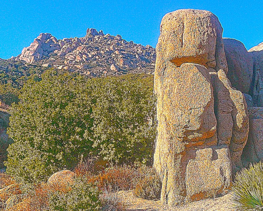
Even taken at close range, a photograph of The Pinnacles fails to capture the overwhelming presence of the rockiest, most-towering prominence northwest of Lake Arrowhead. (Photos by T. Wilcox)
About half a mile into your outing, the pathway descends, then levels off for a stretch before descending once again into another level segment. Here the rocky hill in the foreground begins to obscure the main Pinnacles formation. Even if it’s smaller, the companion pile of boulders is enormous. Soon the principal pile comes back into view.
At two-thirds of a mile, you’ll come to a “Whoa!”granite outcropping that’s reminiscent of the monumental stone sculptures on Easter Island. Pause there for a moment to rest while admiring this natural artwork. Beyond it the trail rises sharply for more than two-tenths of a mile. This is one of the entire route’s steepest stretches, so be prepared for an aerobic workout. When the path levels out into a clearing, you’ll be treated to an awesome (in the true sense of the word) and unobstructed view of The Pinnacles.
Continue on through copious stands of chaparral until you come to the first hiking marker on the route. It’s a stark iron pole bearing the word “TRAIL.” But there’s no directional arrow. A short segment leading uphill dead ends in a thicket. So take the steep downward path to the right, which soon turns left and then left again.
Now the most challenging part of the hike begins. Increasingly, you’ll need to step around and even clamber over boulders that obscure and obstruct the trail. Small stacks of rocks (“cairns”) on the boulders, left by thoughtful hikers, signal that you’re on course.
Be especially careful from this point on as, more and more, you’re challenged to climb over boulders – some of them quite large. A fall could easily result in serious injury. Th
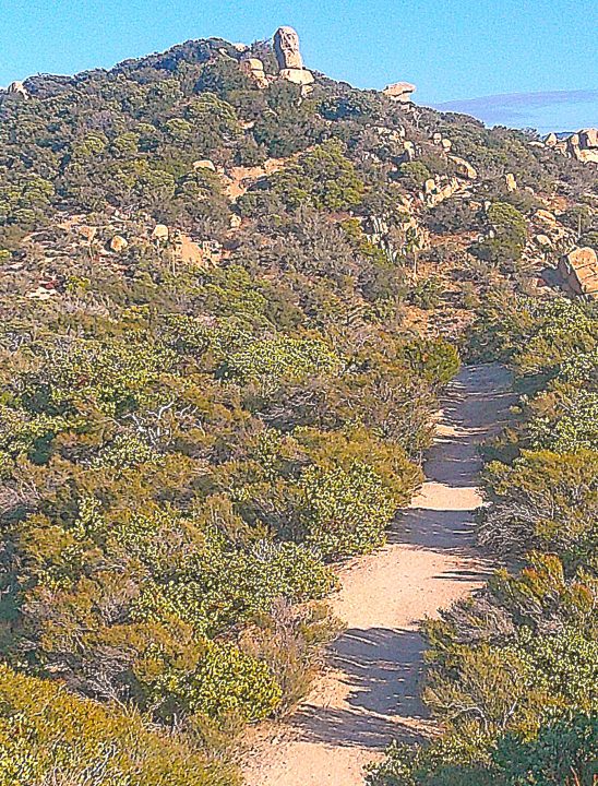
Looking back on The Pinnacles Trail from about the halfway point of the outbound leg, one can clearly see the dominant presence of chaparral.
at said, common sense (Is it common?) suggests that you avoid hiking this trail alone.
Slightly more than 1.5 miles from the trailhead, where the path levels out briefly, you’ll see another iron post that actually points you in the right direction. Turn around for a moment here and savor mountain views to the east and southeast.
Now, proceeding with abundant care up the seriously rocky route, you’re approaching The Pinnacles’ lower summit. Here the boulders looming overhead, while no doubt stationary for millennia, appear poised to tumble without notice. It’s a slightly unsettling illusion.
Finally, exactly two miles from the trailhead, you’ll be looking up at the principal summit. In the foreground is a large boulder bearing a natural mark that looks like a plus sign or a cross. Welcome it as a portent that you’re near hike’s end. About two-tenths of a mile farther, all of your climbing and clambering will be rewarded with panoramic views of the mountains and high desert. It’s a breathtaking buena vista.
When you head back, take it slow and easy – especially through the upper boulder fields. Be mindful of each step. There’s absolutely no need to risk an anticlimax to what should be an invigorating and memorable hike.
NOTES: The Pinnacles Trail offers a delightful change of scene from our typical mountain hikes and also is one of the most daunting routes. The need to scramble around and over boulders, particularly on the upper one-third of the trail, makes it a potentially dangerous foray. Special caution and sturdy hiking boots are mandatory. Solo hiking is discouraged. Views at many points are spectacular.





0 Comments