




By RHEA-FRANCES TETLEY
Historian
The current Top Town area was not the first area where early visitors to the mountains chose to stay. The Skyland area is the oldest and highest part of Crestline. There is evidence from metates near the springs that even the indigenous people choose it as a place to stay.
The Skyland area is located on the south rim of the mountain on the mountaintop, located today just east of Highway 138 and overlooks Highway 18.
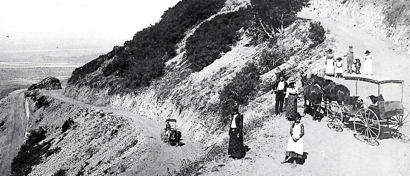
The wagon road to the mountains.
The location, overlooking the San Bernardino Valley, underneath the tall pines, seemed like a natural place to camp for the earliest vacationers in the 1890s, as well. They would come to the mountaintop in the days before air-conditioning for those “sizzling heat weeks” in the valley during August and September when temperatures were frequently over 100 degrees.
The entire mountaintop area at that time was considered “Pineland.” It was 1895 when a group of 40 Colton residents came in horse-drawn wagons, up the Arrowhead Reservoir Toll Road to a place they called Camp Indolence, which was located where Skyland is now. The toll road had been constructed starting in 1891 through Waterman Canyon and cut into the south side of the mountain’s face to bring the bags of cement (from Slover Mountain in Colton) up to build the dam that was planned to create Little Bear reservoir (now Lake Arrowhead). It instantly caught the fancy of nature lovers, who wanted to escape the hot valley summer weather, and to fish and sightsee.
There were no stores in the mountain area early on, so campers had to bring everything they would need for the week or more they planned to stay. The area next to Skyland Peak became a popular area to camp because of the fabulous views all the way past Saddleback Mountain, to the coast and beyond to Catalina Island. That particular area became known as Skyland because it felt so high, like they could almost reach out and touch the sky.
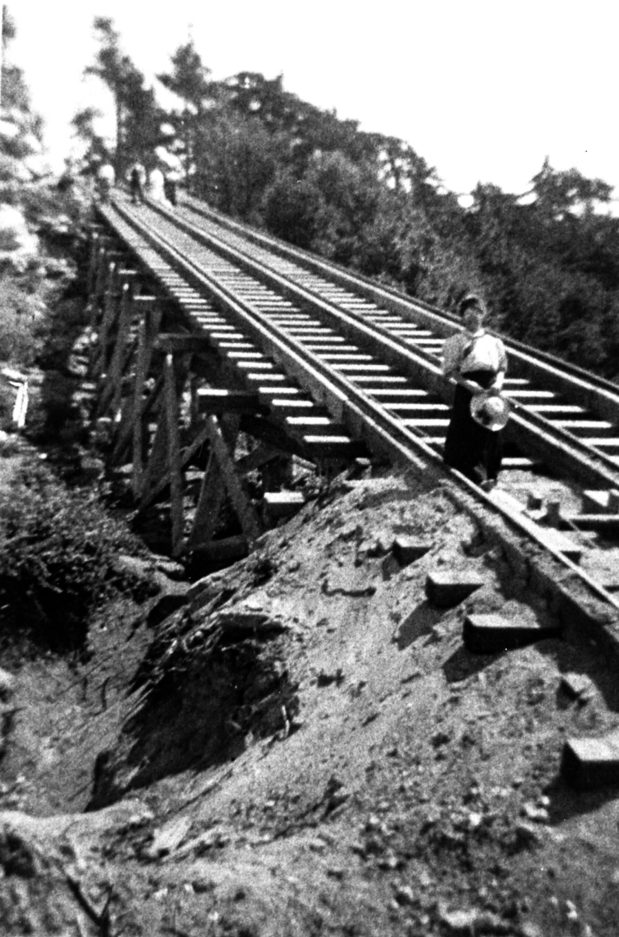
The tracks of the incline railroad, which was never brought to fruition.
Then the local homesteaders in the area, such as the Knapp family (Knapp’s Cutoff), began selling fresh fruits such as apples, milk and veggies to the early resorts and campers in the area. The area became known as Skyland Heights around 1902. That was the year the observation desk was built on the cliff, overlooking the valley below. On many summer evenings, a bonfire would be built that could be seen as far away as Grand Terrace. When the campers returned home, they would tell exciting stories of their adventures on “The Heights.”
The Skyland Inn opened as a hotel/resort next to the campground in 1903, just before the former Arrowhead Reservoir Toll Road became the Rim of the World (public) road in 1905. (That road became Crest Forest Drive in the latter 1920s when the High Gear Road opened. Today, the Skyland area is accessed by either Venus Way or Skyland Drive, from Crest Forest Drive.)
The Incline Railroad was a 4,170-footlong incline cable system designed to bring the needed cement up the mountain to continue building the dam at Little Bear when the reservoir company’s toll road was purchased by the county to make into a public road. The Incline was designed to pull the cement, by cable car, up a 45-degree slope, from the top of Waterman Canyon up to the crest. A large cement base was installed in Skyland to hold the engine used to pull the car up the three-rail track, not far from the campground. It was designed similar to the cable car systems being used on hills in Ohio, by other companies owned by James Mooney, who was the main financier of the Little Bear Lake (Lake Arrowhead) reservoir project.
The construction company did all the important preconstruction work, including surveying, design and grading of the railbed for the cable car system. However, during the construction of the Incline Rail system, there was a heavy rainstorm that washed out about 100 yards of the pre-graded roadbed before the prefab tracks were laid. They didn’t make any changes in the plans, after the storm; they just continued installing the rails through the washed-out area, resulting in a visible dip in the rails, upon completion. The system, which was highly touted and anticipated never worked correctly.
The Incline Post Office was established inside the Skyland Inn general store in June 1907 and named after the cable system. The post office’s name was changed in 1910 to Skyland Heights to reflect its actual location and the abandonment of the Incline Railroad.
Next week, find out which parts of Skyland were burned by the 1907 fire and what remained to burn in the even more devastating fire of 1911.
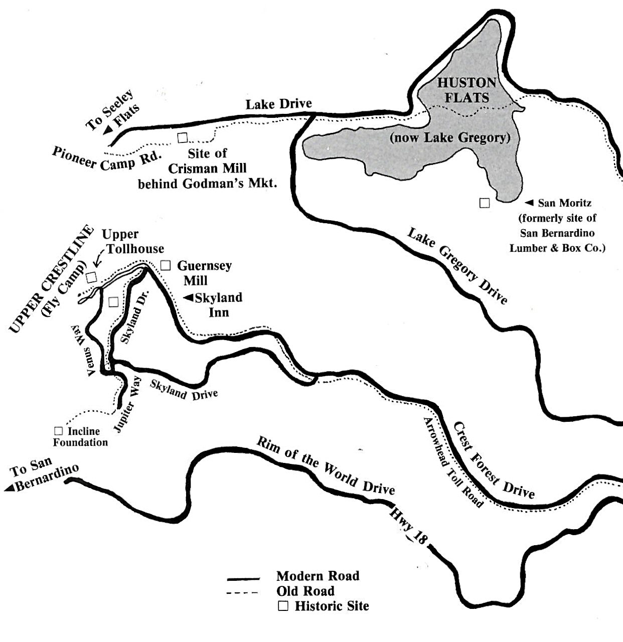
A map showing some of Crestline’s old and modern roads.



0 Comments